
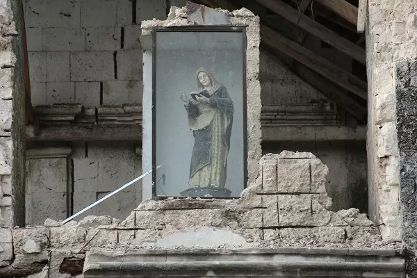
[A religious icon remains encased amid the rubble in Bohol province in central Philippines Wednesday, Oct. 16, 2013, a day after a 7.2-magnitude quake hit Bohol and Cebu provinces. AP PHOTO/KIKO ROSARIO]
Bohol earthquake mirrors Iloilo’s ‘Lady Caycay’
A story from the Panay News, October 17, 2013 (with extensive edits by Fergus)
Photos added from the HistoricPhilippines.com collection.
ILOILO City – Bohol’s 7.2-magnitude earthquake crumbled several centuries-old churches and called to mind a stronger one that hit Iloilo over 60 years ago.
In January 25, 1948 around 1:46 am, a magnitude 8.2 tremor jolted Panay Island and its sleeping people, destroying 55 Spanish-era stone churches and triggering a tsunami.
What would happen to Panay Island and specifically this city now if an earthquake similar to the Lady CayCay quake of the post-World War 2 Philippines struck once again?
An earthquake impact study on Iloilo City conducted by the Philippine Institute of Volcanology and Seismology (Phivolcs) and Geoscience Australia published last year presented earthquake impact estimates resulting from two earthquake scenarios.
It was determined that a repeat of the 1942 8.2-magnitude earthquake would result in over 8,500 buildings being in a completely damaged state, that is to say those that have collapsed or cannot be repaired and would result in approximately 1,500 fatalities.
The study also projected that a smaller magnitude 6.3 earthquake occurring on a blind thrust about 15 kilometres southwest from Iloilo City would result in approximately 2,700 buildings being in a completely damaged state causing about 450 fatalities.
REMEMBER ‘LADY CAYCAY’?
In the past, earthquakes – like typhoons today – were given names. The one that struck Panay Island in 1948, over six decades ago, was called “Lady Caycay.”
“Lady Caycay” is still considered the second biggest earthquake in the 500-year Philippine earthquake history.
The epicenter was reported to have been between Antique’s towns of Tobias Fornier (called “Dao” at that time) and Anini-y.
The tembeling continued for some three minutes, followed by a series of aftershocks which people said were felt until 5:52 am.
Of the 55 churches damaged in Iloilo Province and the rest of Panay Island, 17 totally collapsed including the churches in Igbaras, San Miguel, Oton and Maasin.

Our Lady of Fatima Grotto, St John’s Church, Igbaras, which was formerly part of the sanctuary of the original church.
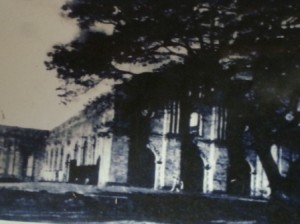
St. John’s church in Igbaras before Lady CayCay.
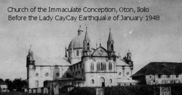
Old Oton Church, before Lady CayCay
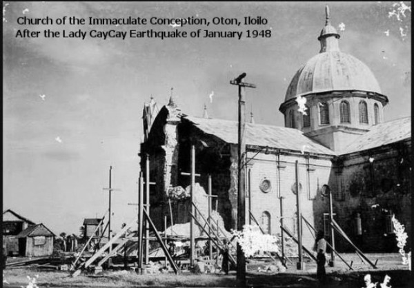
The aftermath of Lady CayCay
Church Belfries in San Joaquin, Alimodian, Tigbauan, Dueñas, Dumangas, Guimbal, Lambunao as well as the Iloilo City district churches in Jaro, Molo and Arevalo were either completely toppled or seriously damaged.
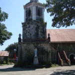
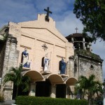


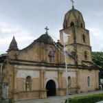
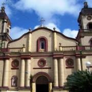
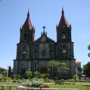
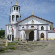
The most prominent of these was the belfry of the Jaro Cathedral. The first storey of that Belfry, constructed off limestone and brick still stands today. “Lady Caycay” toppled Its second and third storeys. It was eventually restored in the 1990’s.

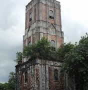
“Lady Caycay” also severely damaged the church and convent of the town of Sta. Barbara, Iloilo, where according to Phivolcs, the temporary belfry also collapsed.
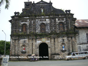
Church of Santa Barbara, Sta Barbara
The study further reported that the fortress church of Miag-ao incurred less severe damage and miraculously survived. Decades later, the Miag-ao Fortress Church was declared a UNESCO World Heritage Site.
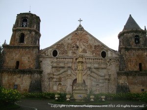
Sto Tomas de Villanueva, Miagao
According to a Manila Times from the time (January 27, 1948) damage to the Church of St John of Sahagun in Tigbauan was estimated to be P50,000 (a huge amount for the time which is equivalent to millions in today’s pesos).
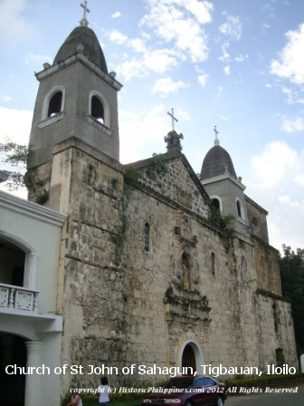
St John of Sahagun Church, Tigbauan
A major and immediate after-effect of “Lady Caycay,” was a tsunami that engulfed the shoreline from San Joaquin to Oton, killing two persons.
The Phivolcs study further reported that newly discovered archival documents have allow Volcanologists to re-evaluate andy re-estimate the magnitude of “Lady Caycay.”
At the time of the “Lady Caycay” earthquake, World War II had just ended. Most communities were only just starting to recover from the disastrous effects of the war and reports were quite sparse; damage due to war and the earthquake were difficult to differentiate.
Using existing reports, there appears to be an incompatibility between intensity distribution and epicenter location and magnitude, the study observed.
“The earthquake’s less serious effects in the epicentral towns of Anini-y and Dao bring the earthquake’s documented location into question,” according to the study.
The pinpointing of Earthquake locations at the time of the 1948 earthquake were notoriously poor owing to the sparse global networks, it explained, thus the actual epicenter of “Lady Caycay” could be “up to 100 kilometres in any direction from the documented location.”
How many died or were injured when “Lady Caycay” struck in 1948, the study did not say.
REDAS
The study used the Rapid Earthquake Damage Assessment System (REDAS) in making the current earthquake projections on Iloilo City.
REDAS has been designed and built by Phivolcs to model a range of potential earthquake-related hazards, including ground shaking, tsunami, inundation, liquefaction and earthquake-triggered landslides.
According to Phivolcs, this new capability in REDAS can be used in two key ways:
1) as a decision support tool for disaster managers during potentially damaging earthquakes, and
2) to target policy makers and local chief executives to use REDAS as a tool for mainstreaming disaster risk reduction into the local development planning process.
According to Phivolcs, because of the country’s tectonic setting, the Philippines experiences frequent damaging earthquakes.
“The archipelago represents a complex system of microplates that are being compressed between two convergent plate margins that bound the nation – the Philippine Sea to the east and Eurasian plates to the west,” it said.
The island of Panay is located partly in a collision zone and the northern extent of the Negros Trench to its south.
Phivolcs said the area is seismically active and is host to many damaging historical earthquakes such as in 1621, 1787, 1887 and the 1948 earthquake./PN