
Typhoon Yolanda – Super Typhoon that ‘hit’ The Eastern Visayas and Northern Panay Island on November 8th 2013.
(with apologies to all our readers for this delay, we’ve been “off the air” without internet service since Friday. November 8th everyone else around here has had internet service since last Saturday, except for Globe Subscribers in our little subdivision…thanks to the incompetence and devil may care attitude of the Management and Staff at Globe Telecom).
If you don’t believe that Climate Change is happening then you need your head read! People like the Canadian Prime Minister, Stephen Harper, don’t believe in Climate Change – well I say: if you believe that Climate Change isn’t happening then you’re a complete and utter idiot. Come here and see Tacloban in Leyte and then tell me that this is not due to climate change – 315 kilometre per hour winds completely destroyed one of the most beautiful cities in this country. 315 kilometre per hour winds – you did see that correctly – that has never been seen before and most weather experts are saying that this is the precursor of what is to come. Storms will become more and more destructive and powerful and there will be more of them if we do not act now to stop pumping carbon emissions in the atmosphere..
Our story starts for me on November 7th, 2013 when I realized after listening ‘BBC World News’ evening report (morning in the UK) here in suburban Iloilo City that this Super Typhoon that was the ‘talk of the town’ was actually coming our way and that the chances were that we’d be taking a hit of some sort. When you’re here in Philippines you have to get your English language news from outside because most news outlets use only the national language (Filipino) as directed by the President – who wants the poor and indigent to be able to understand what going on in their country. 99.9% of the news outlets follow Aquino’s directive and broadcast only in Filipino leaving the hundreds of thousands if not millions of Expatriots who live here and contribute significantly to the financial well being of the country completely out of the loop. They are simply not a consideration and their contributions go unrecognized.
After hearing in one of the Beeb’s lead stories on the Super Typhoon brewing in the Eastern Pacific and heading for a direct hit on the Philippines I started to do some more reading, getting as many newspaper reports or website stories from NOAA and others that had anything to do with this massive potential threat.
![IMG]](/wp-content/uploads/2013/11/IMG.jpg)
The more I read and viewed on-line the more concerned and indeed afraid I became. It looked like, we here in Southwest Panay Island, in the Western Visayas, were headed for a direct head-on encounter with Yolanda. As she approached The Eastern Visayas and specifically the Provinces of Samar and Leyte; she was packing winds ranging between 235 to 255 kilometres per hour. That, as we were learning was placing her in a ‘class’ of her own. She was said to be the most powerful storm, so far, on earth in 2013.
Later, we learned that she was in fact the most powerful storm since records were kept – even bigger than Wilma that devastated the areas around Cancun and then the US Southern Gulf Coast States in 2008. The wind speeds in this storm were clocked at over 310 kilometres per hour. How do you withstand something that strong. Well, in as few words as possible YOU DON’T there is nothing else to do as they say but to “pray to the Lord for when he should come”…!
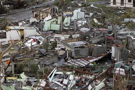
Yolanda carved a swath across Tacloban, the provincial capital 1 kilometre wide and several kilometres long. Everything in that swath was totally wiped out. But not only that the monster winds were accompanied by a storm surge – a wall of sea water which some say was at least 5 metres high. Reports today, Monday, three days later indicate that the final death toll will be at least 10,000 dead and thousands more are injured or missing.
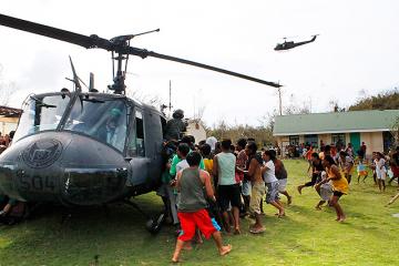
The Philippines Armed Forces have been mobilized and everything the have has been sent to the area to try to help people cope with this unbelievable human disaster. Ever heavy air transport – C-130s, all three of them, every military helicopter and scores of coast guard and navy ship have been sent. The world apparently is also mobilising – sending relief crews and material. People in the area are scavenging for food, there is none. There is no potable water and no ‘municipal’ sewage and water services. It would not be surprising to see massive outbreaks of typhoid and other deadly illnesses brought about by using ‘dirty water’, being surrounded and living in the world’s biggest toilet – there is nowhere to go – so you go wherever you can and with death everywhere. The bodies of the dead lying where they died, decaying and adding to the massive health risks. It looks like HELL ON EARTH. I am certain that Old War Veterans whom we honour today (November 11th) can certainly relate to these scenes of utter and complete devastation.
The World is mobilising to come to the aid of the region. Governments in Canada, the USA, Australia along with European Countries and many others are pledging support, both financial and in terms of human resources. Let’s just hope that any financial aid ends up with the people who need it and not lining the pockets of the myriads of crocked politicians and others who are likely lining up, tasking a number to get their greasy hands on the loot and to hell with the beneficiaries that need it most. “There outta be a law”. Here’s one of the most disgusting examples of a Trapo (traditional politician) and Epal (credit grabber) that you see every where these days who is trying to ‘PROFIT FROM THIS MISFORTUNE OF HIS FELLOW FILIPINOS IN TROUBLE’. He is the current Vice-President of the Republic and his actions area DESPICABLE – He is actually touted as a leading Candidate of the Opposition Party for President in the 2016 National Elections. He should be sent into early retirement!
-

- Jejomar Binay, Vice-President of the Republic
-

- Relief Food Pack with credit grabbing ID
Up until now, Hurricane Wilma in the Gulf of Mexico and the southeastern Gulf Coast states was until Yolanda happened this week the strongest tropical storm that was ever spawned. But these records are fleeting, now we have Yolanda, who is next?
Here are some photos of the devastation we witnessed in Cancun in 2005 – we arrived just a week or so after the storm left for our annual week in the sun before winter really set-in back home. Our resort, the Royal Mayan, was virtually untouched but all around were signs of the devastation. This is obviously nothing, compared to what we have witnessed here in the Visayas.
[left click on any photo to view it larger format]
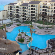
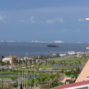
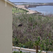
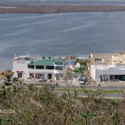
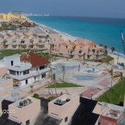
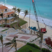
This was the devastation of Hurricane Wilma. She was a category 5 hurricane and was anchored over Cancun, Mexico for just over 3 days, the devastation was indeed a sad sight to see, although our picture really don’t show any of the real serious stuff. She was until Yolanda the strongest tropical storm ever recorded. Our current storm Yolanda, half a world away, was much stronger and the devastation she has left behind is horrifying.

The information we were getting from sources was typically inaccurate and mostly hours out of date…we relied as much as possible on ‘out of country’ reports.
Later in the afternoon of the 7th, you could tell by looking at the skies that something was up. They were turning greyer and greyer and in fact began having a tinge of brown in them. They were coming from the right directions from the North northeast which related exactly to what we were learning in the media.
[left on any photo to view in larger format]
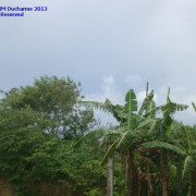
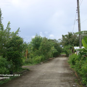
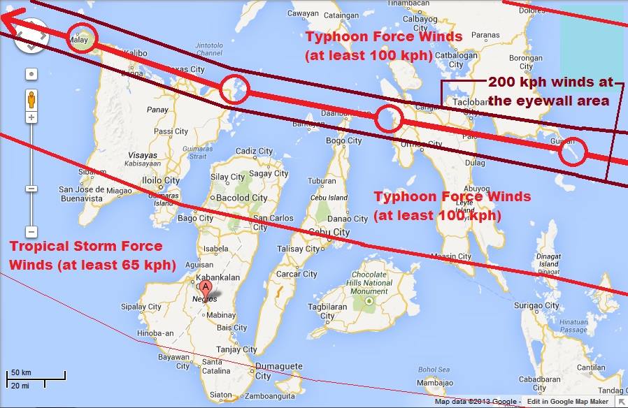
We understood that Yolanda would, if she kept barrelling in on her current trajectory would initially impact Samar, Leyte, the Eastern Visayas and Northern Cebu before continuing on her trajectory to the North northwest and hit Roxas City in Capiz, Kalibo in Aklan before hitting Caticlan and the world famous resort island of Boracay which all lay in an almost straight lines across the northern portion of Panay Island.
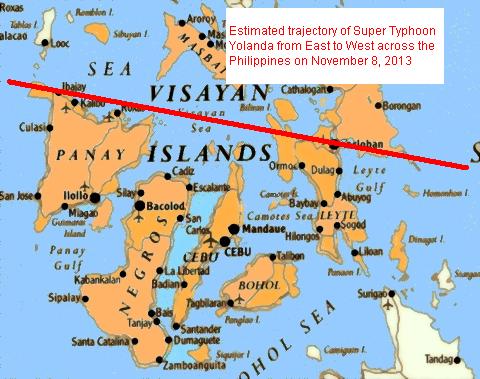
If you follow the red line in the photo above, don’t be fooled, the storm was over 600 kilometres wide, so anyone within 300 kilometres on either side of that red line would feel the full brunt of the storm
It is truly a disaster of epic proportions. But PRIME MINISTER HARPER of Canada, claims there is no such thing as climate change. Look at this and tell me with a straight face that there’s no climate change Prime Minister.
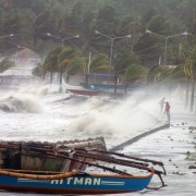
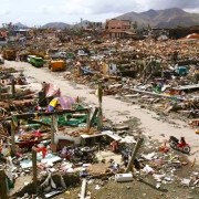
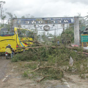

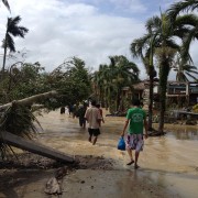
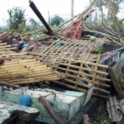
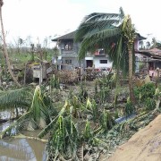
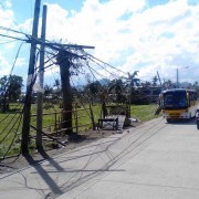
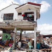
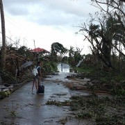
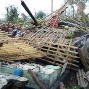
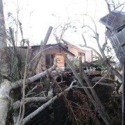
Late in the afternoon of the 7th of November, we headed out to our local mini-mall to get some last minute supplies including: more bottled water, some additional canned goods, batteries, a couple more chargeable flashlights. The surprise I had was that it was so quiet on the 5 minutes drive, there was hardly any traffic on the road and at Gaisano’s, eventhough primary and high schools in Oton had been closed for the day because we were under Signal Two. There are 4 SIGNALS LEVELS issued to the population when there is an incoming weather disturbance. Here’s what all those Signals mean.
PAGASA releases tropical cyclone warnings in the form of Public Storm Warning Signals. An area having a storm signal may be under:
• PSWS #1 – Tropical cyclone winds of 30 km/h (19 mph) to 60 km/h (37 mph) are expected within the next 36 hours. (Note: If a tropical cyclone forms very close to the area, then a shorter lead time is seen on the warning bulletin.)
• PSWS #2 – Tropical cyclone winds of 60 km/h (37 mph) to 100 km/h (62 mph) are expected within the next 24 hours.
• PSWS #3 – Tropical cyclone winds of 100 km/h (62 mph) to 185 km/h (115 mph) are expected within the next 18 hours.
• PSWS #4 – Tropical cyclone winds of greater than 185 km/h (115 mph) are expected within 12 hours.
These storm signals are usually raised when an area (in the Philippines only) is about to be hit by a tropical cyclone. As a tropical cyclone gains strength and/or gets nearer to an area having a storm signal, the warning may be upgraded to a higher one in that particular area (e.g. a signal #1 warning for an area may be increased to signal #3). Conversely, as a tropical cyclone weakens and/or gets farther to an area, it may be downgraded to a lower signal or may be lifted (that is, an area will have no storm signal).
Classes for preschool are cancelled when Signal #1 is in effect. High school classes and below are cancelled under Signal #2 and classes for colleges and universities and below are cancelled under Signal #3 and Signal #4.
This is the end of Part 1 of the Typhoon Yolanda, story. We will have Part 2 tomorrow.